Some context to this blog post – I’ve got a couple more blog posts on the go and viz projects that are a little bit stalled. I have every intention of getting them moving again in the near future, but on days like this when momentum is low, it’s nice to revert to some of my more favourite experiments (I originally put “visualisations” here but that might be a stretch).
If you’ve been following my blog for a while you’ll know I’ve had of fun experimenting with tile maps – either geographical regions which you tend not to see using tile maps, unconventional tile shapes, or both. Some of these can be found on these pages here and here. But on seeing Klaus Schulte’s visualisation from last year again which used trapeziums, I fancied another experiment. What other shapes can we use?
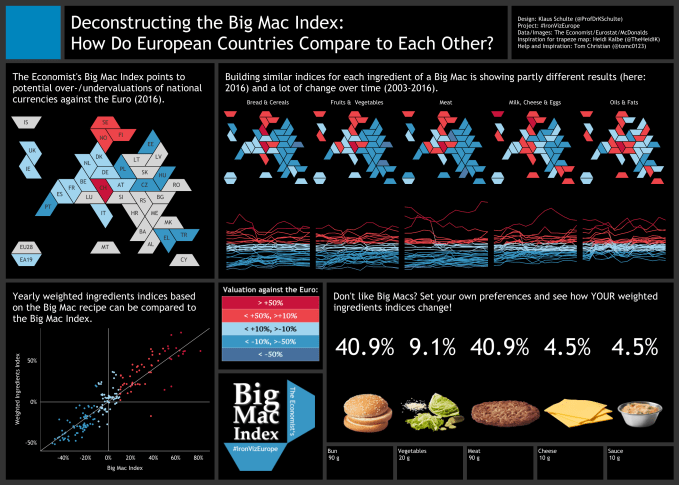
Here’s Klaus’ award-winning viz:
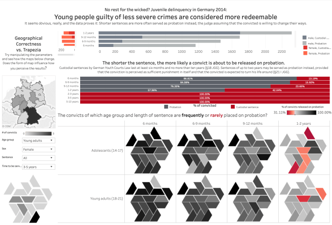
Klaus’ visualisation was inspired by the fantastic example below from fellow country-person Heidi Kalbe. She includes the geographically correct map too on the left hand side to allow readers to make the connection from tile map to regular map, a really nice touch.
Both of these show that you can align and tile more irregular-shaped polygons by rotating to fit your overall region geography. So this got me thinking – any shape or combination of shapes that allow for interlocking pieces (most likely, shapes with external angles that are divisors of 360 degrees) could conceivably be used. We’re not generally trying to pack our tiles into a regular shaped square, rectangle or triangle, since countries themselves are not regularly shaped, so this allows for much more irregular tiling within the “interior” of a tile map. The only stipulation, for a regulation tile map at least, is that tile areas are all the same.
So onto a familiar geography to try some new things. Let’s come up with some new tile maps for the USA. As mentioned above, there’s no getting around the fact in the USA that you’d have to have Rhode Island, California and Alaska all the same size. But that’s just tile maps for you. I started off trying to tesselate using L-shapes:
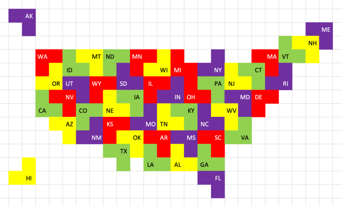
Not bad – this works quite nicely on the far left hand side of the map, but so many of the larger US states are very square, meaning that the shape isn’t really that great in this case. I do think this might be a really interesting tile map shape to use for other maps, so I’ll keep my eyes open (and I’d love to hear your suggestions or see your own attempts!). But back to the USA. What if I could use different shapes – L-shapes and squares, and maybe other shapes too if I could be sure all tiles were the same area?
Thankfully a Russian game company has had similar thoughts on tiling equal sized shapes before. Remember Tetris? 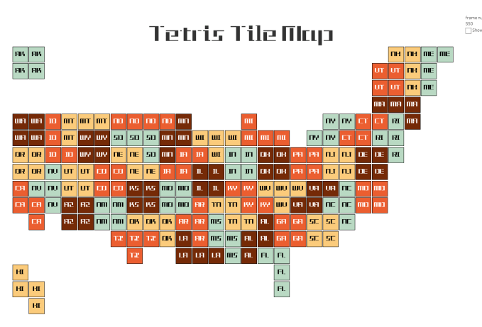
What if we tiled the US using Tetris shapes? Fun to do, this worked out nicely. L-shapes for Florida and Idaho, T-shape for Texas, and lots of 2×2 squares for the more regular shaped states like Colorado and Utah. It’s impossible to do, whichever tile shapes you use, without bulging the eastern side of the States disproportionately. But you get this with squares or hexagons too.
Now Tetris isn’t Tetris without the building process, so I couldn’t resist this:
So I don’t know what this proves – it’s unlikely you’ll ever want to use a Tetris tile map as the basis of a serious visualisation unless perhaps you’re visualising computer game sales or the metaphor is otherwise equally relevant. But it does show, like the trapezium tile maps, that if you want to tile using non-regular shapes (shapes that don’t have rotational symmetry, that you can tile at different angles), that there are a lot more options that might make tile maps more accessible (or more fun).
